


Shape Library
Create accurate, contiguous territories fast with an up-to-date library of states, ZIPs, and MSAs.
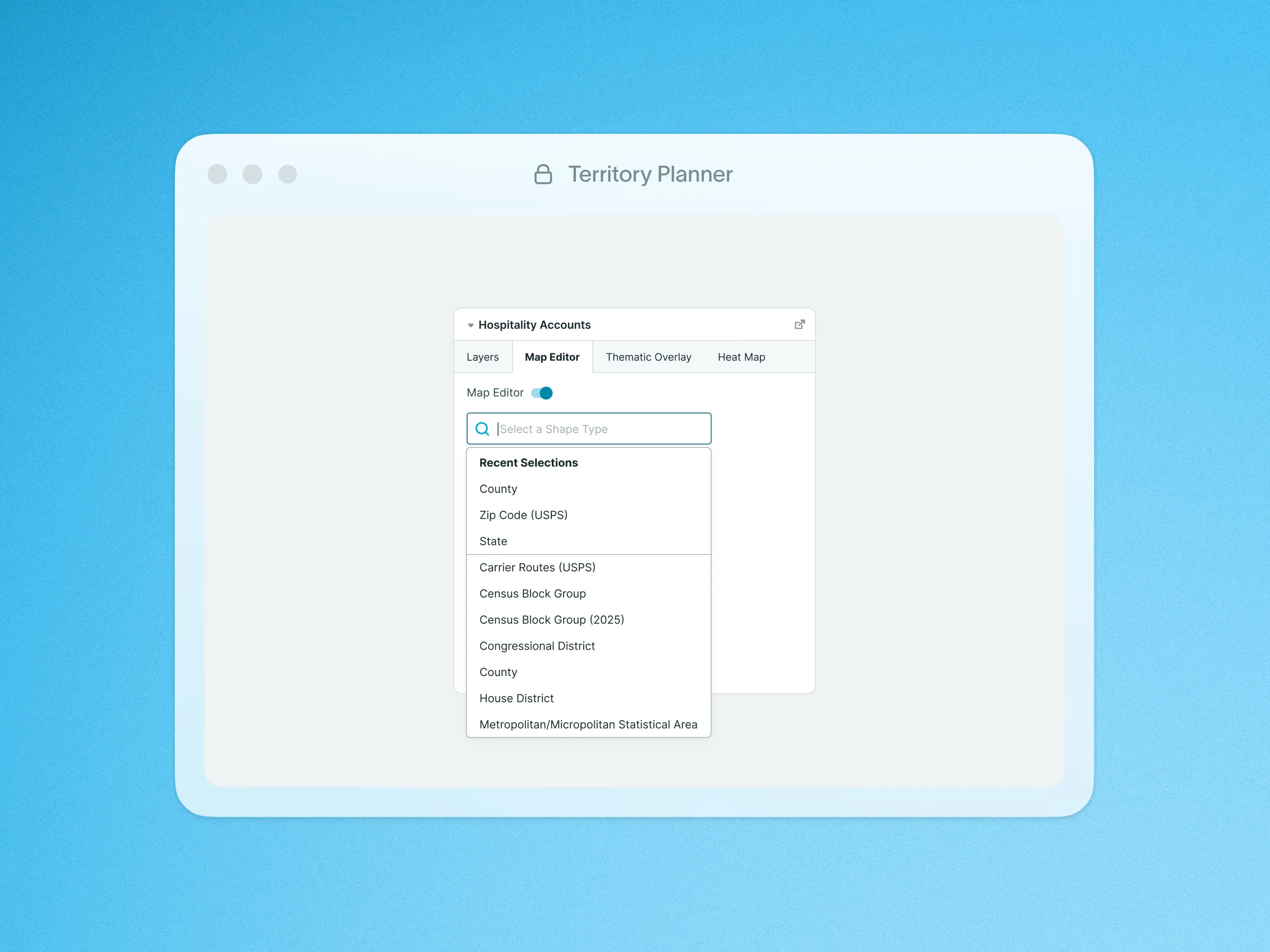
Territory Planner provides an industry-leading library of geographical boundaries to use for visualizing, searching, and managing territories. With data from all over the world, the Shape Library enables users to create, edit, and update Shapes in our Shape Editor and use those Shapes for any number of business applications.
Available boundaries include States, Postal Codes, and Metropolitan Statistical Regions (MSAs), making it easy to create accurate and contiguous territory shapes. When editing a Model Set, you can choose one of these boundaries as Shape Types on its own or combine them to define territories and select the Shapes to include on the map. You can also use the Data Summary feature with additional aggregated insights to segment territories strategically.
To learn more about Shape Library, visit our help site.