


Shape Library
Create accurate shapes from rich boundary data and reuse them across territories, routing, and field workflows.
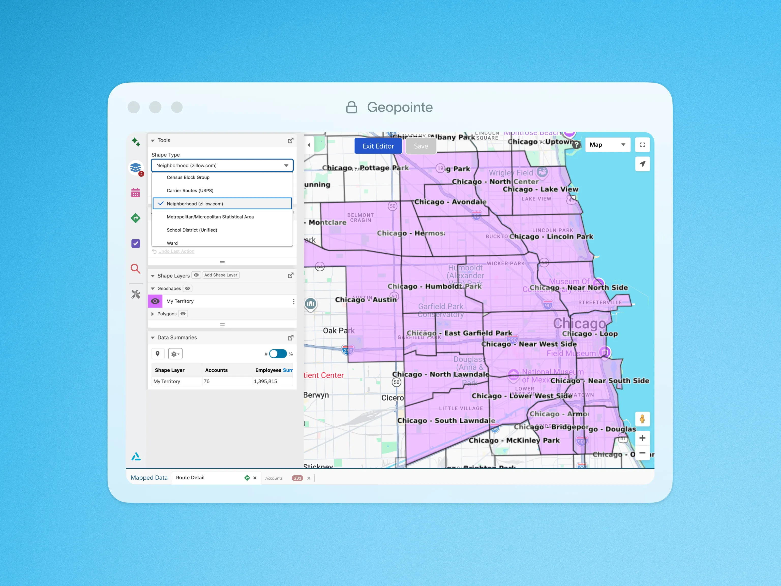
Geopointe provides a rich set of boundary data to use for searching, managing territories and coordinating location-specific processes. With licensed data from all over the world, the Geopointe Shape Library allows users to create shapes with a visual editor and use those shapes for any number of business applications.
Available boundaries include countries, time zones, and postal codes for many countries, with more boundaries being added all the time. United States boundaries include states, counties, neighborhoods, school districts and more. Use these shapes on their own, or combine them into larger shapes to define territories, narrow down a search or implement other location-specific processes.
To learn more about the Geopointe Shape Library, visit our help site.
Click below for a quick look at Shape Library in action.

.webp)