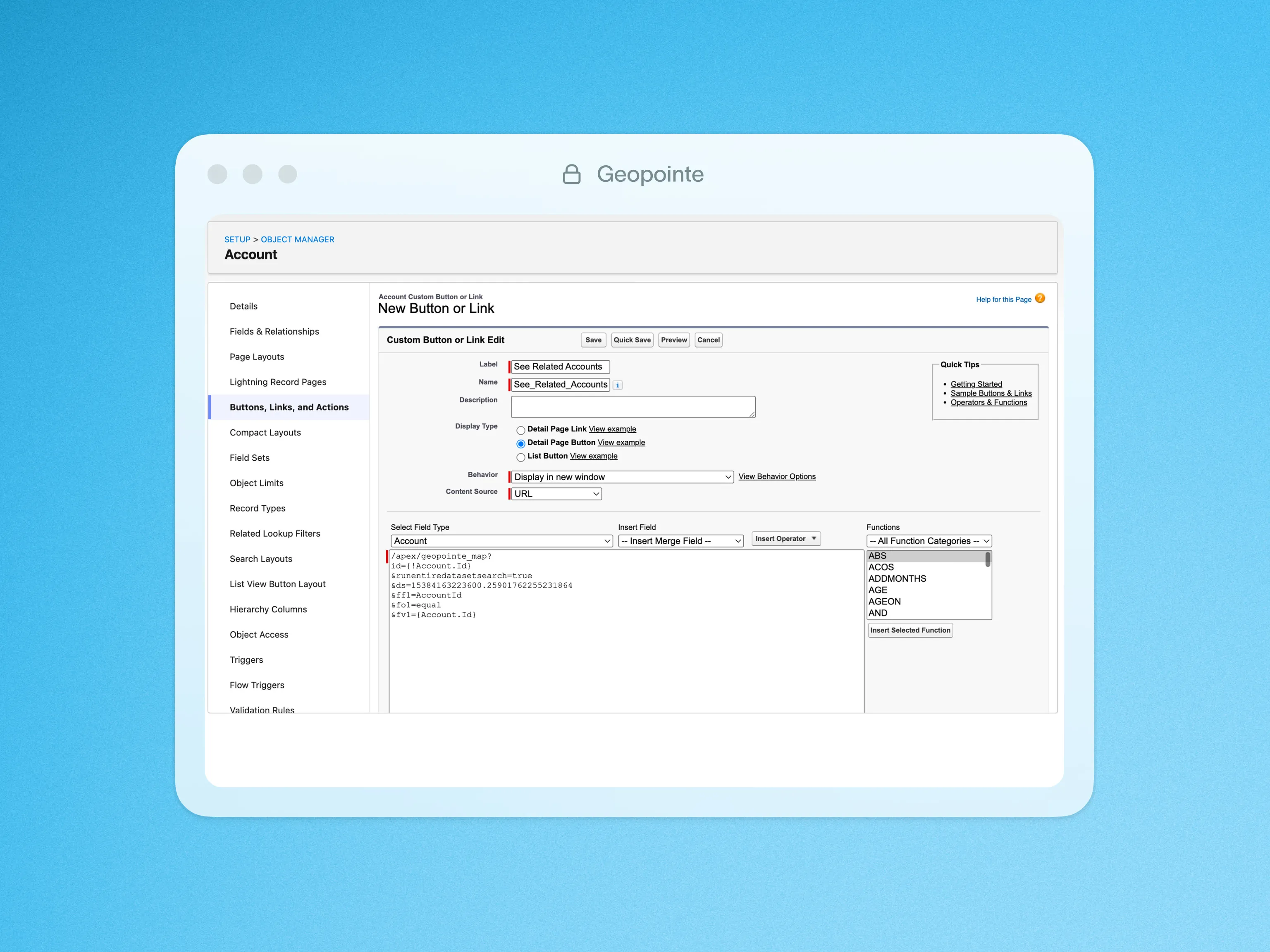


CSV Layers
Import CSV files directly to the Geopointe Map, without standard Salesforce import method.

Import CSV files directly to the Geopointe Map
Import CSV files directly to the Geopointe Map, without the need for the standard Salesforce import method. You can save these files as new layers and work with them similar to Data Sets, with visualization tools, actions, and geographic search methods.
All that is required is that the CSV contain some address information or coordinates. Geopointe will geocode the location of points based on any address fields provided. If coordinates are provided, it will map those points instantly.
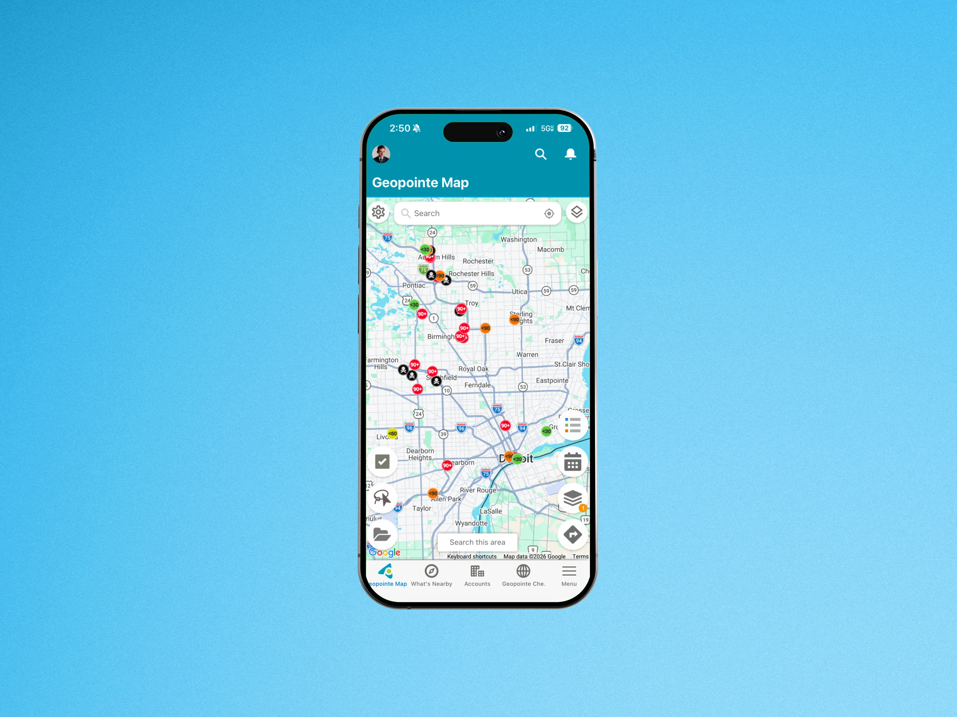
Once you create a CSV layer, you can share it with others, set up point actions, apply heat mapping and other visualizations, and export the results of your data manipulation for analysis.
Learn more about CSV Layers.
Click below for a quick look at CSV Layers in action.

.webp)